


SIDE SCAN SONAR MARINE SURVEY
Copyright Sea Scan Survey Pty. Ltd. All Rights Reserved.
Website by VP-IT
Geographical Surveys - Search & Salvage
Marina, Structural & Hull Inspections
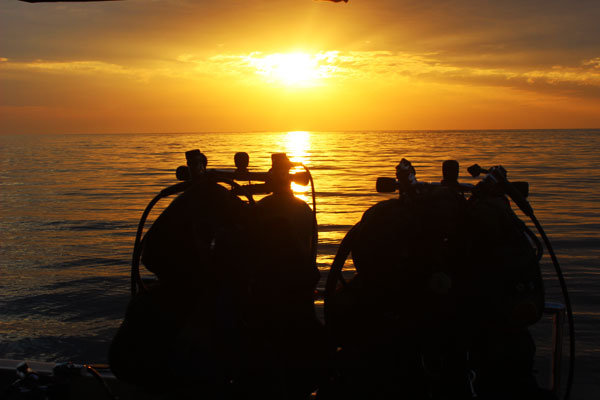
Technical & Rebreather Diving


AUSTRALIA + 61 4 8800 6501
PHILIPPINES + 63 917 165 7240


EQUIPMENT
Survey, Mapping, Scanning, Diving, Search, Testing, Remote Operated Vehicle


- Douglas A-1 Skyraider Wreck - Subic Bay
- MV Princess of The Orient Discovery
- USS Flier Discovery
- Manila Bay Wreck
- US Navy LCM-3 Wreck Discovery
- PSAI Advanced Wreck Penetration Course
- Sonar Scan in Subic Bay
- North American AJ-2 Savage Bomber - Outside Subic Bay
- Nakajima Ki-43 Fighter Wreck Discovery Near Coron
- IJN Auxiliary Submarine Chaser Kyo Maru No. 11 Wreck
- "Nikko Maru" Wreck - Banshu Maru No. 52


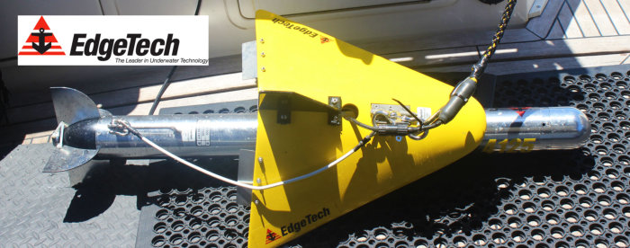

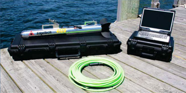
EdgeTech 4125 Side Scan Sonar
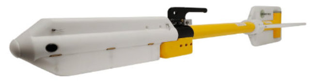
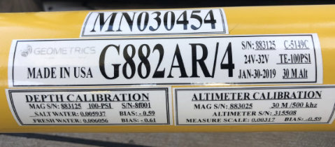
Geometrics 882 Cesium Vapour Magnetometer
Geographical grid survey work
Locating shipwrecks and geological features,
giving depth and GPS positions of targets


Seafloor Mapping
Seabed Magnetic Surveys
Mapping of ferrous objects of all sizes (anchors, chains, cables, pipelines,
ballast stones, other scattered shipwreck debris, munitions of all sizes
(UXO), aircraft, engines, other objects with a magnetic expression

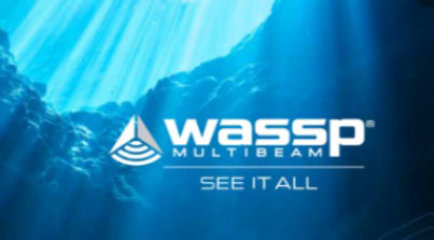
WASSP Multibeam Sounder
Seabed topography
3D mapping


Bathymetric 3D Seafloor Mapping
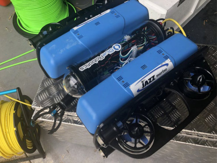
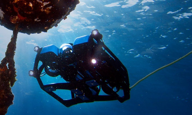
Remote Operated Vehicle (ROV)
Blue Robotics tethered heavy configuration ROV
Low light still cameras and 4K video camera
Newton Subsea grab manipulator arm


SEAS VC700 Vibracoring System
Lithological and contaminated sediment studies
On-site surface processing


Vibracore Scanning and Core Tests
Commercial & Technical Diving
Blue Robotics tethered heavy configuration ROV
Low light still cameras and 4K video camera
Newton Subsea grab manipulator arm


Blue Robotics Remote Operated Vehicle (ROV)
SEAS VC700 Vibracoring System


Associated companies: